| CURRENT WEATHER | RADAR | SATELLITE | RAINFALL | WARNINGS | NWS FORECASTS |
| TROPICAL CYCLONES | MARINE | CLIMATE | GUIDES | OTHER RESOURCES |
***Mexico Information***
**Observations**
CURRENT MESONET SFC OBS - National Weather Service thru MesoWest
California Real Time Observations from National Weather Service
CURRENT SOCAL SFC OBS - University of Washington
CURRENT NORCAL SFC OBS - University of Washington
...Updated 09/13/2015...
*** NWS CONUS SELECTABLE ***
Fox Weather SSMI Moisture Analysis F15-1 (passworded)
Fox Weather SSMI Moisture Analysis F15-2 (passworded)
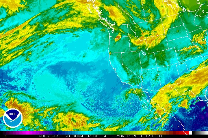
Latest 11 um Infrared Image of East N Pacific and West U.S. (NWS)
IR Loop E North Pacific/West US (NWS)
Alternate IR Loop E North Pacific (NWS)
NE Pacific TPW DMSP Microwave Image
NE Pacific SSMIRR Microwave Image
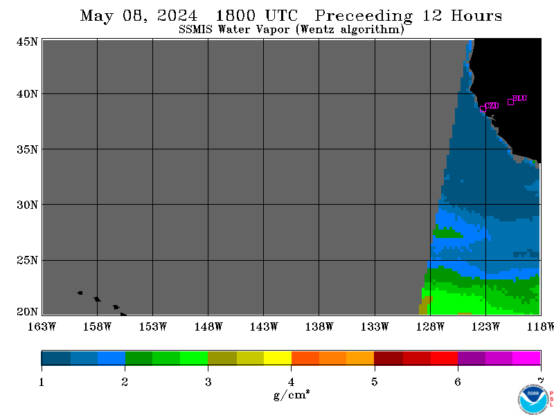
NOAA/ESRL/PSD SSMI/SSMIS Integrated Water Vapor
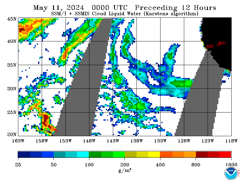
NOAA/ESRL/PSD SSMI/SSMIS Columnar Liquid (Clouds/Precip)
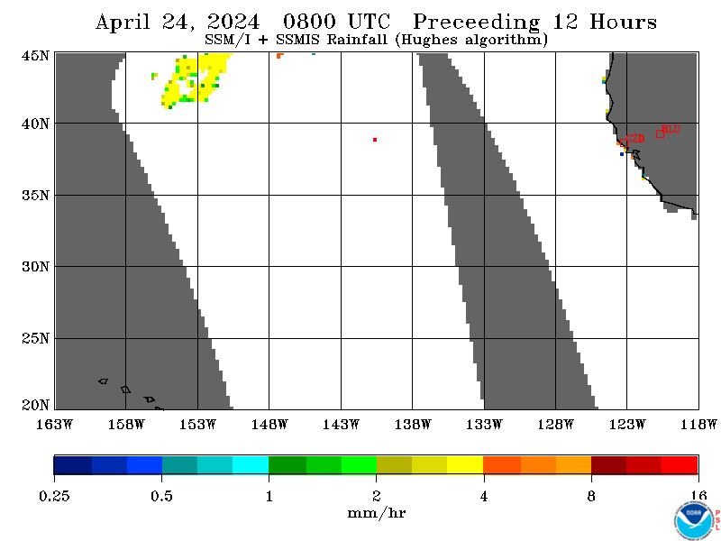
NOAA/ESRL/PSD SSMI/SSMIS Rain Rate
Satellite Nocturnal Low Cloud Marine Stratus Delineation
WestUS and E Pacific Visible Image Loop (NWS)
Latest Visible Image of East N Pacific and West U.S. (NWS)
Latest High Resolution Visible Image for Northern California. Naval Research Laboratory, Monterey
Latest 1km Visible Image -under construction- for Far Southern California
Latest 1km Visible Image -under construction - for Arizona
Latest 1km Visible Image -under construction - for Southern Nevada
GOES-East IR (NWS)GOES-West IR (NOAA) Loop
GOES-West
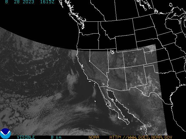
VIS(NOAA)
California Real Time Rainfall Summary Alternate Site Calif Real Time Rainfall
Ventura County Watershed Protection District Rainfall Data
County of Santa Cruz Real Time Rainfall Data
San Bernardino County Flood Control Rainfall Data
Orange County PFRD Real Time Rainfall
...Page Updated 09/13/2015...
Marine Weather Plots (Eastern N Pacific from Oceanweather, Inc.
Marine Weather Plots (Near California Coast) from Oceanweather, Inc.